Mojave Trail to Laughlin

Klever

Well-known member
Joined
Apr 7, 2022
Messages
301
Does anyone have ONX or some older GPS that can help me plan a route from Hesperia to Laughlin taking the Mojave Trail?


I have 2 GPS in my truck: Lowrance GlobalMap BAJA 540C and Lowrance GlobalMap 7200C (I have ZERO idea how to work them) Same with ONX ha ha


I only have a 50 gallon fuel cell and get about 3-4 mpg.
 
@sdecurti may have a file that you can use.

Most of the time you can convert a GPX file to whatever file template your system runs.

If you are only getting 3-4 MPG then you'll need to stop in Baker to refuel. With that said a lot of this trail isn't flat footed so you could probably get better millage then that? With that said I'd still plan a stop at Baker to refuel.
 
Thanks man!

Actually Desert_Steve sent me a file and walked me through it! I "think" I have it figured out ha ha.

Yeah I will stop as many times as I can find. Yeah the 427 Ford, 39's, TH400, 5.43 is a thirsty girl ha ha! I might be able to pussy foot it and hopefully get better 🤪

I remember a few years ago, I filled up at Newberry Springs.

I have heard there are many trails....just want to make sure I take the correct one.
 
Yeah. The 'correct' one is well marked and traveled. Pretty easy to stay on if you have an idea of where you are going.

I remember doing it at night with my buddy chris in his 4runner. No GPS and it was relatively stock. Took about 6 hours at a cruise...

Are you going this weekend for Rage?
 
Yeah I remember....kind of....I was a druken passenger.

Ha ha yeah last time it took us like 9 hours...too many trucks, too many issues.

Yeah, I am hoping my buddy with the almost twin truck as mine (actually I think you know him...Eric Reynolds) won't back out. Rage at the River is a good time!

We plan to leave from Rob's house RJ FAB
 
Rad! Should be a fun trip and yeah if you guys don't have issues it shouldn't take as long... We typically jump on the trail at the water crossing through and that's at Afton Canyon. So you guys will be starting a lot further back but your trucks are all fast!
 
Yeah! Oh nice...I mean we could take more street...but leaving from Robs is the closest spot I know to leave our trailers etc.

I would like to avoid the water crossing ha ha. Hopefully we can manage around it.

Thanks man. We cruise though ha ha
 
Yeah! Oh nice...I mean we could take more street...but leaving from Robs is the closest spot I know to leave our trailers etc.

I would like to avoid the water crossing ha ha. Hopefully we can manage around it.

Thanks man. We cruise though ha ha
I believe the water crossing is only 1 ft deep now. They filled it in with Rock so that they could work on the rail road. I haven't personally driven past it but I saw a bunch of pictures where the trucks tires were hardly in any water.
 
That's what Ive heard. Just not a fan of driving my truck through super deep water. I try not to introduce water to it very often (IE washing, mud, etc). Ha ha
 
When I ran it last year, there were two back to back. If you're going east, the first one is pretty filled in, so not very deep. The second one right after was deeper right next to the bridge, but staying on the far side it was only maybe 2 - 2.5 feet deep.

When we pulled up there was a raptor with the intake apart. Apparently he was a little heavy on the pedal and got too wet. There was also a stock wrangler and ram truck that made it through just fine though.

I'd be more worried about the dry lake bed not being so dry
 
Thnks for the insight man!

In 2018, somehow we avoided the water crossing and the train tracks. I think we're just going to wing it this time ha ha.

I have the GPS file that Desert Steve sent me. Thanks again Desert Steve!
 
Yea there's bypasses that you can take for stuff that's prone to be gnarly. I think trailsoffroad has them.

Let us know how the trail looks. I saw some photos from the last big rain storm that showed some really washed out sections now.
 
Yeah I just don't want deep water crossings is all ha ha

Will do!
 
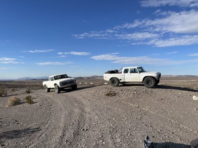
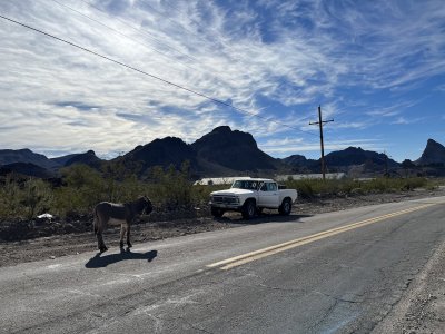
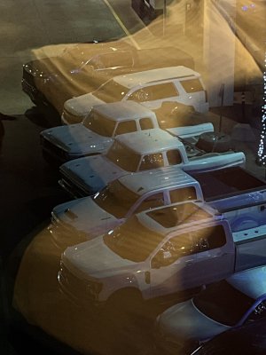
Holy balls was it a long haul out there....drove 280 dirt miles one way....got 4mpg. Some cool roads though. The water crossing was super easy and not deep at all....probably the prettiest part of the whole trip. I didn't take but 3 pictures ha ha. All Trails app is WAY better than ONX. But I still suck at technology. It probably took me 25 mins to add these pictures ha!
 

Attachments

  • Mojave Rd.jpg
    Mojave Rd.jpg
    537.9 KB · Views: 23
  • Oatman.jpg
    Oatman.jpg
    478.4 KB · Views: 23
  • Laughlin.jpg
    Laughlin.jpg
    232.7 KB · Views: 24
Glad to hear it went well. It's kind of one of those must do trails in SoCal.

Guessing you didn't stop at the lava tubes or make it up to cruthers canyon though?
 
It's one of those fun trails that can be done as fast or slow as you want. First time I did it, we took 4 days. Saw all kinds of stuff, did some shooting, only drove when the sun was up. It was nice to not be in any rush
 
True!

Oh that would be more enoyable. Sounds like fun. A long travel Bronco would be sweet for this type of thing.

We averaged 47mph. Super easy to make a wrong turn and get lost too ha ha
 
Back
Top